![]()
![]()
![]()
THE IST AREA EXCAVATIONS
Mihriban Özbaşaran and Güneş Duru
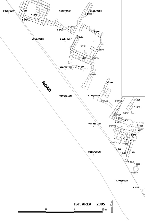
The aim of Team IST focuses on the investigation of the earliest levels at Çatalhöyük. The area chosen for this objective was the southwest slope of the mound (Figure 22). In 2005 an area of more than 300 sq m was scraped; buildings, open spaces, kerpiç pavements (?), kerpiç walls, and a midden area(?) were documented and planned, and excavations were carried out mainly around a burnt building Space 252. The area as a whole is dated to Level IV/V by the pottery and the chipped stone.
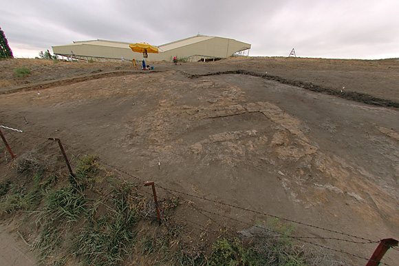
Figure 22. The IST Area is located on the southwest slope of the mound; an area of more than 300 sq m was scraped revealing many wall alignments. |
It seems that the Space 252 building was partially burnt. It includes many fragments of kerpiç/mud plaster, most probably used in the roof construction. Burnt, negative impressions of reeds and/or branches were found often especially in the southern part of the building at different elevations. A collapsed kerpiç wall (F.1965) with nine courses of blocks was exposed in the eastern half of the room. However its original location and its stratigraphy need to be reconsidered next season. Various finds on the other hand came from the fill just above the floor level, at around 1005.8m. One of the most interesting finds of the building is a clay female figurine (12401.x7) with her head missing (see Figure 3). She seems to be pregnant on the front with an exaggerated belly. Her back on the other hand represents her skeleton. While her vertebrae, scapula and probably pelvis (?) were shown in relief and by incision, the ribs were only incised. It was found close to the west wall of the building, in the burnt fill, ca 0.3m above the floor level. Other finds in the same area include worked stones, polishing stones, ground stones, a shaft straightener (?) and a finely worked mace-head (?) made of limestone.
Their positions in general do not indicate their original position/location. When the building is excavated as a whole next season it is hoped that the inner structures and the architectural elements will be better understood and the position of the finds will be better interpreted.
The preliminary results of the work in Area IST can be summarised as: the southwest slope of the mound was densely inhabited by terracing; the southwest limit of the settlement continues further to the southwest, beyond the present village road/fences indicating that the settlement was much larger; the excavated area can provisionally and relatively be dated to a settlement phase later than Level VI.
 |
![]()
![]()
![]()