![]()
![]()
![]()
THE SELCUK SURVEY
Ahmet Tırpan and Asuman Baldıran
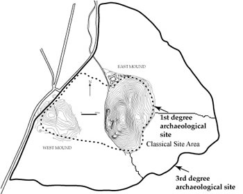
Figure 23. Plan showing location of the SEL Area in relation to the East and West mounds. |
The Selcuk team that has joined us from Selcuk University in Konya, led by Ahmet Tırpan and Asuman Baldıran began work by organizing surface collections and geophysical prospection over the historic site on the plain to the east of the East Mound (Figure 23). This geophysical work was undertaken in two areas within the 3rd degree SIT Area that is on the east of Catalhoyuk, between the 17.08.2005 and 20.08.2005.
During this project, resistivity and georadar methods, which are the most sensitive techniques, were used for tracing the archaeological material (Figure 24). The geophysical study was undertaken in Area I (4800 sq m, 48x100) and in area II (2400 sq m, 48x50). 5332 electric measurements were taken on a total of 62 cross sections (Area I, southeast-northwest directed, 41 cross-sections(CH1-CH41) and Area II, 21 cross section (CH42-CH62)). Moreover the measurements were taken by the georadar on a total of 6 cross-sections (CHR1,1A , 3, 39, 48 and CHR57-61) in both areas which have anomalies.
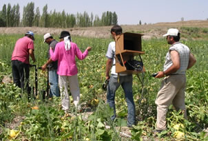
Figure 24. Resistivity and georadar methods were employed to map the archaeological deposits. |
The project was run by the geophysical engineers Ismail Erguder, Abdulkadir Sucu and Oner Ozdemir and 5 workmen were also employed by the project. Previous geophysics reports for the Catalhoyuk East Mound were also available as a reference.
![]()
![]()
![]()